
Trace a San Juan Street Directory
Begin a San Juan street directory search with the present address, then follow the parcel rather than guessing from a surname. Hidalgo County Appraisal District, known as HCAD, is the current address and ownership starting point. Its public materials describe searches by owner name, street address, or account number. Save the result's owner name, account, situs address, mailing address, legal description, value and exemption clues. Next, use the city map for geographic context and the County Clerk index for the instrument behind a transfer. Each layer is independent, which makes comparison more useful than a single match.
- Search the address in the HCAD Public Portal and record the account number, situs, owner, mailing address, and legal description.
- Locate the same parcel in the San Juan GIS map to check city limits, zoning, subdivision geometry, and county precinct context.
- Use the owner or legal description in the County Clerk's Official Records Search, then read the grantor, grantee, recording date, document number, and deed type.
- Use Texas My Voter Portal only to check an individual registration question. It is not a screen for listing a whole street.
- For a dated occupant clue, ask the San Juan Memorial Library about reverse directories, then use the TSLAC Hidalgo microfilm guide for the UTRGV route and compare any entry with deeds and maps.
The sequence helps separate an owner from a resident and a current address from an older one. A deed may use a subdivision, lot, block, or metes-and-bounds description instead of the modern street number. When that happens, the legal description becomes the bridge. If the purpose changes from an address trail to checking one known person, the separate San Juan resident lookup has a name-centered workflow.
Read a San Juan Street Parcel First
HCAD is an appraisal district, not the office that proves title. Its parcel information is still the fastest present-day way to anchor a San Juan street directory search. The available appraisal materials describe ownership, address, homestead information, living area, land size, age, class, construction type, and related property characteristics. A parcel card can also distinguish the property location from the tax mailing address. That distinction matters. A mailing address can be outside San Juan or a post office box, so it is a tax-contact clue, not evidence that the owner lives at the property.
| HCAD field | Form | Needed? | San Juan search use |
|---|---|---|---|
| Owner name | Text | Optional | Use surname and first-name variants; exact current syntax was not exposed. |
| Property address | Text | Optional | Use the street number and name; try direction and suffix variants if needed. |
| Account number | Text | Optional | Use the appraisal identifier saved from the parcel card; format was not published. |
| Tax year | Dropdown or text | Optional | Current and prior-year availability should be checked in the live portal. |
| Legal description | Text | Optional | Use lot, block, subdivision, or other legal text when a street address fails. |
A homestead exemption can suggest owner occupancy, but it does not identify each person in a household or prove occupancy today. Treat the parcel result as the start of an address trail. Move to the deed index before treating an ownership label as conclusive.
Note: The research did not verify a public HCAD street-browse or ZIP-wide filter, so repeated address searches and map browsing are safer than assuming either control exists.
Map San Juan Street Geography
San Juan Planning and Zoning links the city's GIS map for property information, zoning, city limits, permit or utility jurisdiction, and county Precinct 1 or 2 context outside municipal jurisdiction. Use that map to place a parcel along the street, then pan or select neighboring parcels as the interface permits. The inspected public material did not document a buffer tool, a fixed layer list, or popup fields. It is more accurate to describe the map as a way to inspect location and jurisdiction than as a legal survey or a title source.
The San Juan Planning and Zoning page shows the city route to its interactive GIS and permit information.
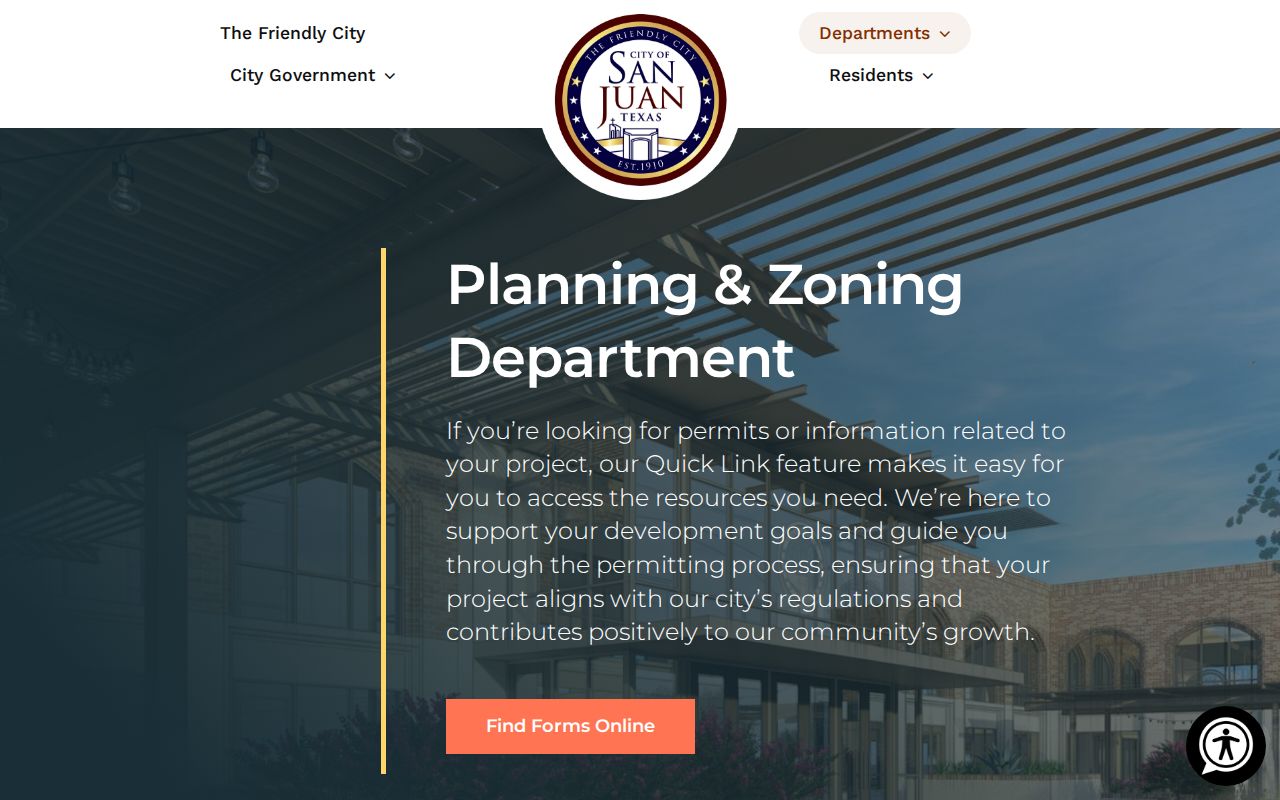
Use the GIS result beside the HCAD situs and the legal description, especially where city limits, postal labels, and county jurisdiction do not line up. The map gives context; recorded plats, surveys, and deeds settle the legal land description.
San Juan Street Records by Address
Several Hidalgo County record sets can be keyed to a San Juan address, yet none is a complete street roster. HCAD provides the appraisal parcel. City GIS adds physical and jurisdictional context. The County Clerk index records transfers and encumbrances by parties and legal description. Planning files can place work at an address. The voter layer is narrower still, because the public state tool is an individual registration lookup. A historical reverse directory may supply a dated occupant, but the local San Juan run has not been confirmed. Read each source for its own purpose.
| San Juan address record | Custodian | Useful fields | Access route |
|---|---|---|---|
| Appraisal parcel | HCAD | Owner, situs, mailing address, account, value, exemptions, legal description | Public portal, office, or phone fallback |
| GIS parcel | San Juan Planning and Zoning | Parcel geography, city limits, zoning, and jurisdiction clues | Interactive city map |
| Deed, lien, or plat | Hidalgo County Clerk | Grantor, grantee, instrument date and type, legal description | Official Records Search, counter, mail, or request |
| Permit or code file | San Juan Planning and Zoning | Project address, work type, applicant or contractor where shown | Forms route or Texas Public Information Act request |
| Historical reverse directory | Library, UTRGV, or TSLAC | Dated occupant, telephone, or occupation when listed | Reference, microfilm, or digitized collection |
The account number and legal description are useful join points. A street name may take you to the current parcel, while lot and block take you to a plat and a deed. That is why a San Juan by-address search should preserve all three address forms instead of relying on one field.
Follow a San Juan Street Deed Chain
The Hidalgo County Official Records Search is the recording layer for warranty deeds, liens, cemetery deeds, trustee's deeds, foreclosures, judgments, subdivision plats, and financing statements. Quick Search accepts a search term for grantor or grantee, subdivision, document type, or document number. It also offers recorded-date fields and a choice between Index Only and Index & Full Text OCR. The OCR choice searches document contents as a phrase when two or more words are entered. The portal states certification through August 24, 2026, but does not publish an online historical cutoff or image price.
The official-records search screen is the source shown here, including its date controls and index or OCR scope choice.
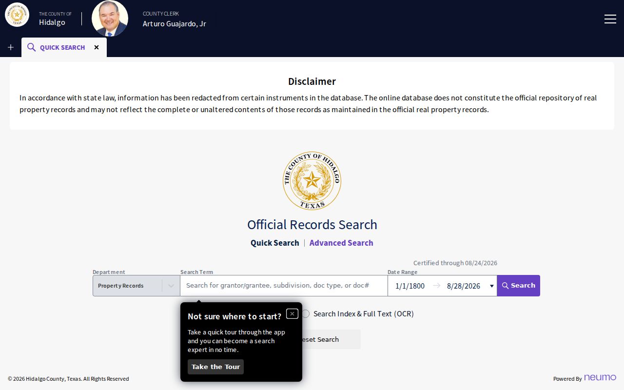
For an address chain, start with a current owner as grantee, read the purchase instrument, then search the earlier grantor as a prior grantee. Old instruments may omit a street address, so use the subdivision, lot, block, or legal description. The portal is a current online route; the Texas State Library and Archives Commission lists older Hidalgo deed material on UTRGV microfilm beginning in 1852.
Use San Juan Street Address Labels
Address terms often look interchangeable, but they identify different parts of a record trail. A careful San Juan street directory search labels what each source actually reports. That prevents a tax contact from becoming an assumed occupant or a mailing city from becoming an assumed municipal address. It also makes an older deed easier to match with a present parcel when the street number is missing.
- Parcel
- An appraisal or tax unit tied to land and property data. It may have an account number and a GIS shape, but it is not itself a title document.
- Situs address
- The physical taxable location of the parcel in San Juan. It is the useful key for modern assessor, GIS, and permit research.
- Mailing address
- The address used for tax correspondence. It can be a post office box, business, or an address outside San Juan.
- Plat
- A recorded subdivision map that connects a street to a lot and block. It helps translate a modern address into a deed-search description.
- Criss-cross directory
- A reverse directory arranged by address, used to find a dated occupant entry when a local volume is available.
Hidalgo records also include a Spanish-transcribed deed run from 1854 through 1896 and separate direct and reverse indexes. Preserve accents, compound surnames, initials, and name order when a legal description leads from a San Juan street to an older party search.
Keep the San Juan Street Voter Layer Narrow
Texas My Voter Portal asks for a name, county, date of birth, and ZIP to display individual registration information and a Voter Unique Identifier. It is not a public tool for showing everyone on a San Juan street. A result can concern registration status, precinct, districts, residence or substitute mailing address, and related election administration information, subject to confidentiality rules. Texas has no permanent party registration, and ballot choices are not exposed. A protected voter or Safe at Home participant may have address information withheld or restricted.
Hidalgo Elections handles fuller voter-file requests through its published form. The form has identity and contact fields, district checkboxes, an hourly charge notice, and a statement that fulfillment may take up to ten business days. It also cites Texas Election Code §18.009 on prohibited use of registration-list information. Use the Texas My Voter Portal for a lawful individual verification and ask the county directly when an existing official file is genuinely needed.
Note: A current voter record supports an election-administration question, not a conclusion that every person at a San Juan address is registered or still present.
Time a San Juan Street with Permits
San Juan Planning and Zoning is a useful address-history layer because its listed services include building and site construction, excavation, occupancy and health, conditional use, zoning, subdivision, variance, lien, and inspection matters. The city's materials say permits are required for construction, additions, structural alteration, excavation, utilities, and related work. The city audit reported 744 building permits issued in fiscal year 2024. That number shows why permit files can add useful dates to a San Juan street trail.
No verified public address-search screen for historical San Juan permits was located. For a specific existing permit or code record, use the forms route or submit a focused request under the Texas Public Information Act process listed by the City Secretary. State the address, record type, and date range. A permit applicant or contractor can document work at a property, but it is not proof of who lived there.
Place Past San Juan Street Occupants
Reverse directories are arranged by address, and city or telephone directories may give an address and occupation. They can put a named occupant at a San Juan street on the date of an edition. The exact local run has not been published in the sources reviewed, so ask San Juan Memorial Library, UTRGV, TSLAC, and WorldCat for a collection-level description rather than assuming a volume exists. Read the abbreviation key and street spelling before matching a house number.
Pair a dated entry with a deed, census schedule, obituary, probate file, map, or plat. Sanborn material covers San Juan from 1925 through 1938, while TSLAC catalog records include San Juan maps for 1961, 1972, 1983, 1988, and 1992. Those sources can bridge an older street pattern to today's parcel. The historical shelf and its access routes are covered in the San Juan Directory Book.
Limits of a San Juan Street Directory
A San Juan street directory cannot create a complete household list. HCAD identifies an owner and tax-related parcel details, not every occupant. A homestead exemption is only an owner-occupancy clue. The public voter tool is individual, not street-wide. Permits associate work with an address, but do not prove residence. Utility customer lists are not public resident sources, and driver address records are restricted by the federal Driver's Privacy Protection Act. Historical directory entries are dated evidence, not title proof.
When an online result is incomplete, use the custodian that holds the record. HCAD can address appraisal data; the County Clerk can address recorded instruments; Planning and Zoning can address existing city permit material; and a library or archive can identify older directories or maps. A missing search result can reflect an unindexed, older, confidential, or differently described record.