
San Juan ZIP Directory Core
The confirmed postal core for San Juan is ZIP 78589, a standard ZIP whose preferred city is San Juan, Texas. That is the one confirmed local entry in the San Juan ZIP code directory. Search results can also surface 78516 for nearby Alamo and 78577 for nearby Pharr. Those are neighboring postal geographies, not San Juan ZIPs unless a USPS address result assigns a particular address to one of them. The boundary polygon and every acceptable city-name label were not captured in the reviewed USPS result, so they should not be guessed.
| Postal ZIP | Area in a San Juan search | Preferred postal city | Research note |
|---|---|---|---|
| 78589 | San Juan and postal delivery area around the city | San Juan, Texas | Confirmed standard ZIP; the ZIP boundary does not prove city-limit inclusion. |
| 78516 | Nearby Alamo-area postal geography | Alamo, Texas | May appear in nearby results; do not treat it as San Juan without a USPS result for the address. |
| 78577 | Nearby Pharr-area postal geography | Pharr, Texas | May appear in nearby results; do not treat it as San Juan without a USPS result for the address. |
Postal geography is a delivery tool. It is not a household list, a municipal map, or evidence that a named person is at an address. That limit is central to any responsible San Juan ZIP directory search.
Verify San Juan ZIP Labels Through USPS
USPS provides three practical checks for a San Juan ZIP. The first works from an address. The second begins with a city and state. The third begins with a ZIP to show cities covered. For a specific delivery question, use the address route and preserve the spelling that USPS returns. USPS warns that a result does not confirm who is at the address. It verifies postal addressing, not a resident claim.
| USPS route | Fields supplied | Required input | Useful result |
|---|---|---|---|
| Find by address | Company, street address, apartment or suite, city, state, ZIP | Address details needed for a match | Standardized delivery address and ZIP information |
| Find by city and state | City and state | City and state | Postal ZIP results for the submitted locality |
| Find cities by ZIP | ZIP | ZIP | Cities covered by that postal ZIP |
The USPS ZIP Lookup is the source shown in this capture, with its address, city-and-state, and ZIP-to-city routes.
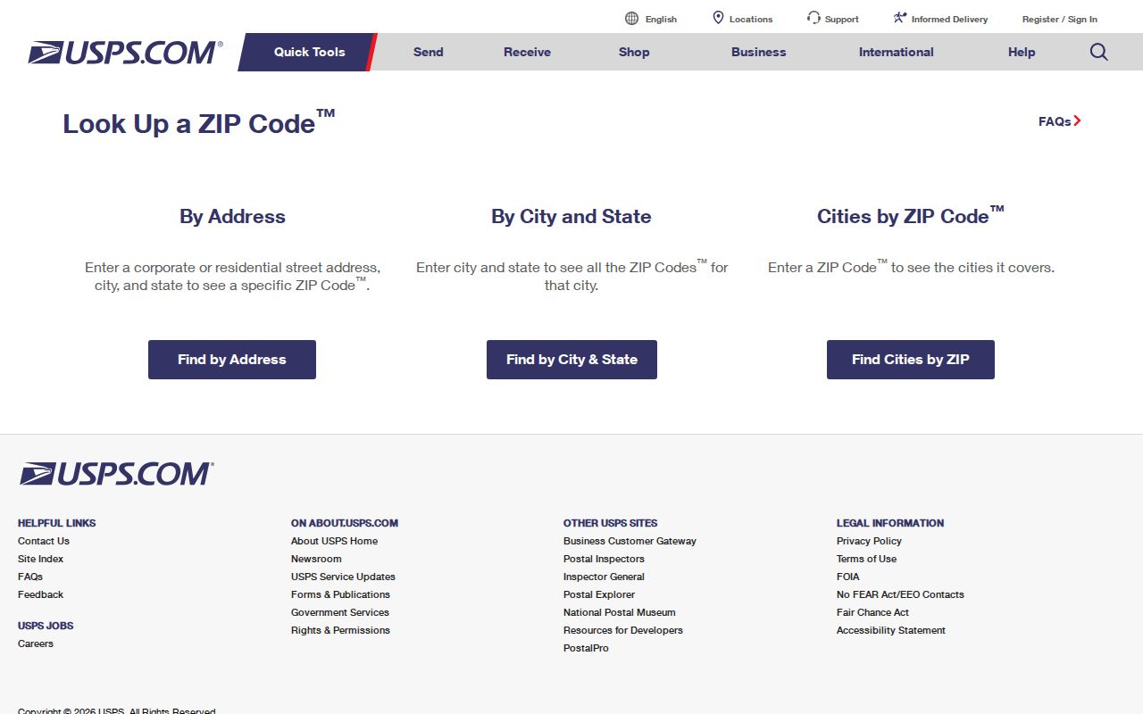
Use the USPS answer before searching another database. A standardized San Juan postal label reduces false misses caused by an abbreviated street suffix, an apartment field, or a nearby city label.
Separate San Juan ZIP Neighbors
San Juan sits among Pharr, Alamo, McAllen, Edinburg, Hidalgo, and other Hidalgo County communities. Older directories, newspaper notices, deeds, and voter searches may use a postal city, municipality, county subdivision, or rural label that does not match the modern San Juan label. Nearby 78516 and 78577 are therefore useful prompts to verify an address, not substitutes for the verified 78589 postal core. A municipality and a postal service use different boundaries for different purposes.
When a search result is unexpected, retain the exact city, ZIP, street spelling, and legal description as separate fields. This is especially helpful with Spanish surnames, compound surnames, initials, accents, or name-order variants in Hidalgo County records. A postal label may change the search terms without changing the parcel that a deed or appraisal record describes.
Find San Juan Residents by ZIP
A ZIP can narrow an address inquiry, but the official San Juan tools do not all offer a verified ZIP-wide resident search. HCAD's reviewed field inventory marked ZIP filtering as not exposed. Hidalgo voter material is organized around precinct and district, not ZIP. That means the strongest workflow starts with USPS, then uses address-keyed parcel and GIS records. Do not claim a whole ZIP as a resident list when the available public tools do not support that result.
- Use USPS to verify the address's ZIP and preferred postal city.
- Search the verified street address in the HCAD Public Portal for its situs, account, owner, mailing address, and legal description.
- Check the San Juan GIS map for city limits, zoning, property information, and city or county jurisdiction.
- Use the legal description or owner in the Hidalgo County deed index when a land-transfer question remains.
- Use Texas My Voter Portal only for a lawful individual registration check, not as a ZIP-wide roster.
Once a ZIP has narrowed the question to a particular street or parcel, the San Juan Street Directory follows the address record chain in more detail. ZIP geography is the filter; the parcel and legal description carry the property research.
Know San Juan ZIP Filter Limits
The HCAD research supports owner, property-address, account-number, tax-year, and legal-description searching. It did not verify a ZIP filter in the current public interface. The city GIS text confirms city limits, zoning, property information, permit or utility jurisdiction, and county precinct context, but it did not expose a dedicated ZIP layer or published filter control. Hidalgo election requests are district-oriented. These limits matter because a ZIP directory should describe a search capability only when the source actually shows it.
For a government record not posted online, a focused request under the Texas Public Information Act can ask for an existing record by address, date range, or record type. San Juan's City Secretary accepts city requests by email, mail, or in person. A request asks the custodian to locate an existing record; it does not require the city or county to create a new ZIP-wide roll.
Note: USPS is the verified ZIP checker here; parcel, GIS, and election systems require their own address, account, precinct, or name inputs.
Check San Juan ZIP City Limits
A San Juan ZIP and the San Juan city limit are different boundaries. A road or subdivision can carry a postal city that differs from municipal jurisdiction. The city Planning and Zoning page states that its GIS can identify city limits, zoning, property information, utilities or permit jurisdiction, and Hidalgo County Precinct 1 or 2 for places outside municipal jurisdiction. Use that map to test the city side of an address after USPS confirms its delivery label.
The San Juan Planning and Zoning page is the source for the city GIS and jurisdiction-check route shown below.

The same map helps explain why a postal result and a local permit or zoning result can use different labels. For property ownership or a legal boundary, use the parcel, recorded plat, survey, and deed rather than treating a screen map as final proof.
Match San Juan ZIP Address Keys
A ZIP is only one of several address keys that appear in San Juan records. The situs is the taxable physical location used by modern appraisal, GIS, and permit research. A mailing address is where tax notices go. The legal description identifies land in deeds through lot, block, subdivision, or metes-and-bounds language. These keys can agree, but they are not interchangeable. Keep them together when an address appears under a nearby postal city or an older map label.
- ZIP
- A postal delivery area used to route mail. It does not draw the municipal boundary or identify an occupant.
- ZIP+4
- An added postal detail that narrows delivery beyond the basic ZIP. It is not a parcel identifier.
- Post office box ZIP
- A ZIP used for post office box delivery rather than a general street-delivery area.
- Unique ZIP
- A postal ZIP assigned to a single institution or organization. No San Juan unique ZIP was established in the reviewed research.
- Carrier route
- A delivery route used by postal carriers. It is not a public list of households.
Recorded plats, survey and field-note microfilm from 1881 through 1941, and TSLAC San Juan map records can help bridge a legal description to a later street label. The property address keys modern records; the legal description keys deeds; and the ZIP keys delivery verification.
Use San Juan ZIP Community Certificates
Texas HOA management certificates add a limited community layer to a San Juan ZIP search. The state database filters by association name, county, city, ZIP, and association type, then links results to PDFs. San Juan and 78589 results include VIP East Homeowners Association, Pedro Pedraza, THE GROVE Property Owners Association, and Stewart Place Estates No. 2 Homeowners Association. The useful result is a registered association or management contact, not a membership list or proof that a particular person lives at an address.
The Texas HOA management-certificate search is the source shown here, including its San Juan and ZIP filter choices.
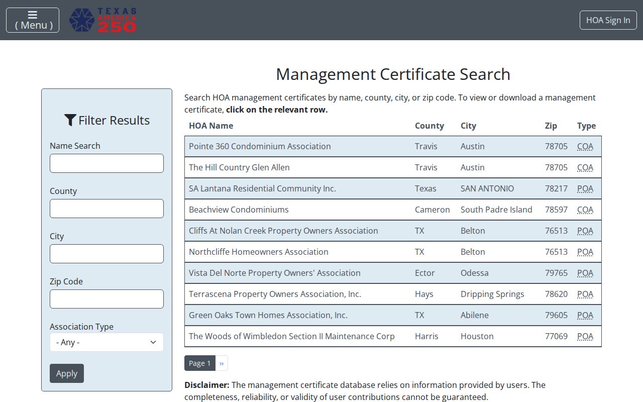
The database warns that certificate completeness and reliability are not guaranteed because information is user supplied. Use a PDF as a community-management lead, then verify property or city questions through the appropriate official custodian.
Bridge San Juan ZIP History with Maps
Old address research can require a map bridge because a historical record may carry a different street pattern, subdivision label, or postal city. Sanborn coverage for San Juan runs from 1925 through 1938. TSLAC map catalog records list San Juan material for 1961, 1972, 1983, 1988, and 1992. The 1961 county map has a San Juan subdivision inset and identifies local post offices, cemeteries, railroads, canals, utilities, and settlements. These editions can help match an older description to a present parcel.
No verified local street-renumbering or E911 readdressing year was located. Do not invent one when a ZIP, street number, or postal city fails to match. Instead, compare the deed's legal description with plats, the historical maps, and the current HCAD situs. That evidence can explain a mismatch without treating a postal label as a legal description.
Limits of a San Juan ZIP Directory
A San Juan ZIP code directory cannot reveal everyone who receives mail in a delivery area. USPS says its result does not confirm a person at an address. HCAD identifies parcel and owner information, not every household member. A tax mailing address can differ from the situs. The voter portal is for individual registration information and protected records may be restricted. An HOA certificate can identify an association contact but not each resident. A ZIP is a useful filter only when it is kept in its postal role.
For an unclear address, verify USPS delivery first, then compare HCAD, the city GIS, and a recorded legal description. Contact the record custodian if the needed existing record is absent online. This sequence respects the difference between postal delivery, municipal jurisdiction, property ownership, and individual residence.